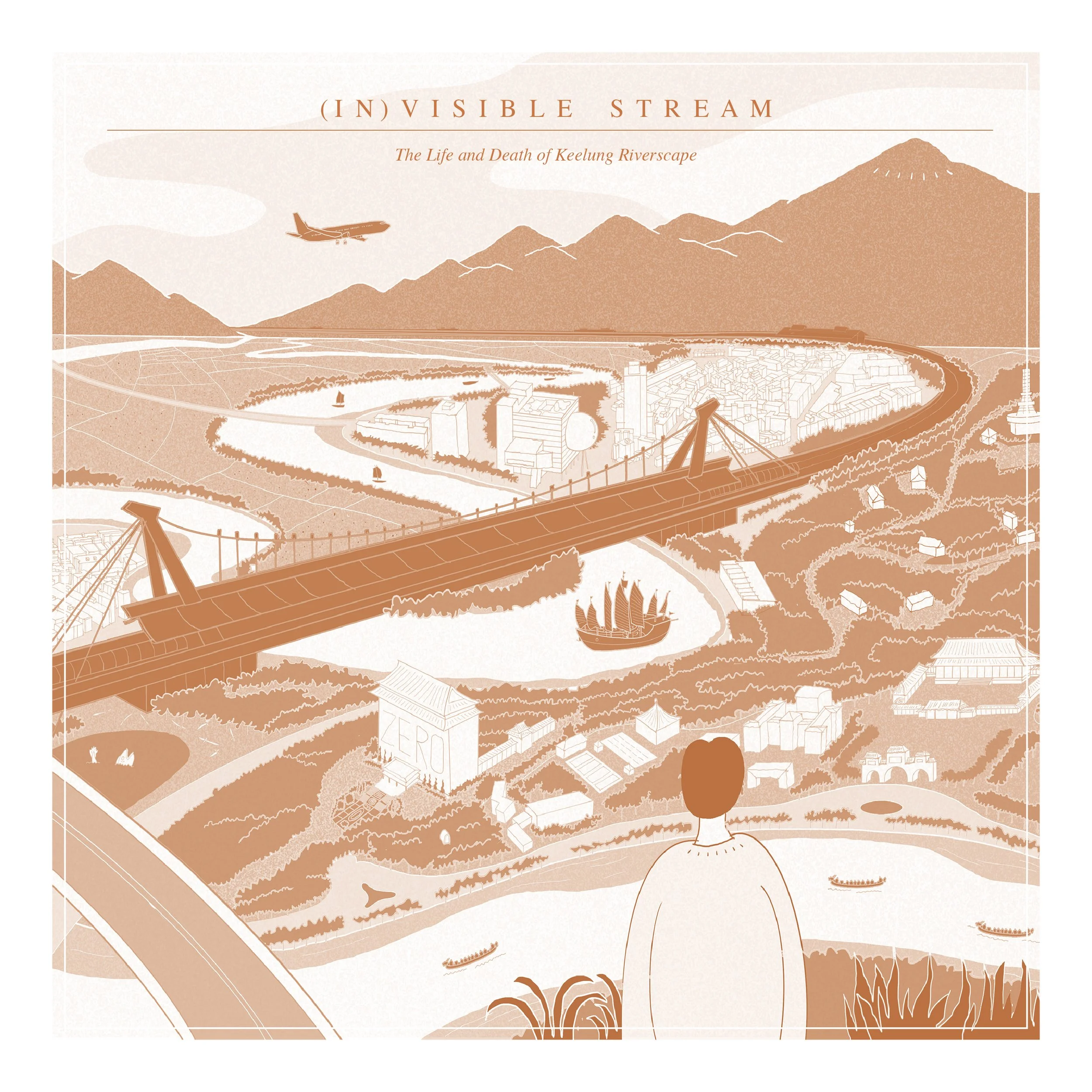
Invisible Stream
A critical cut: from riverscape to landscape
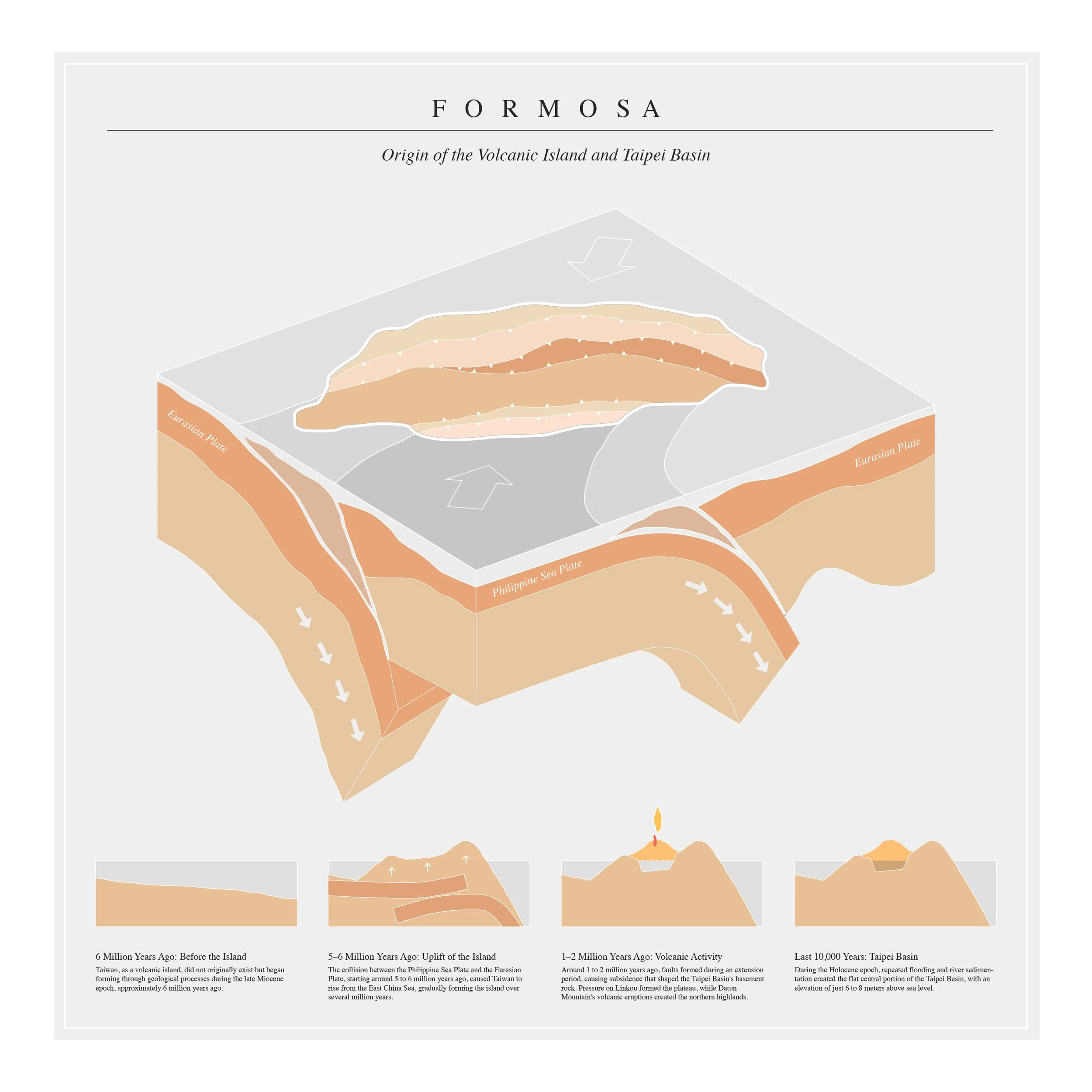
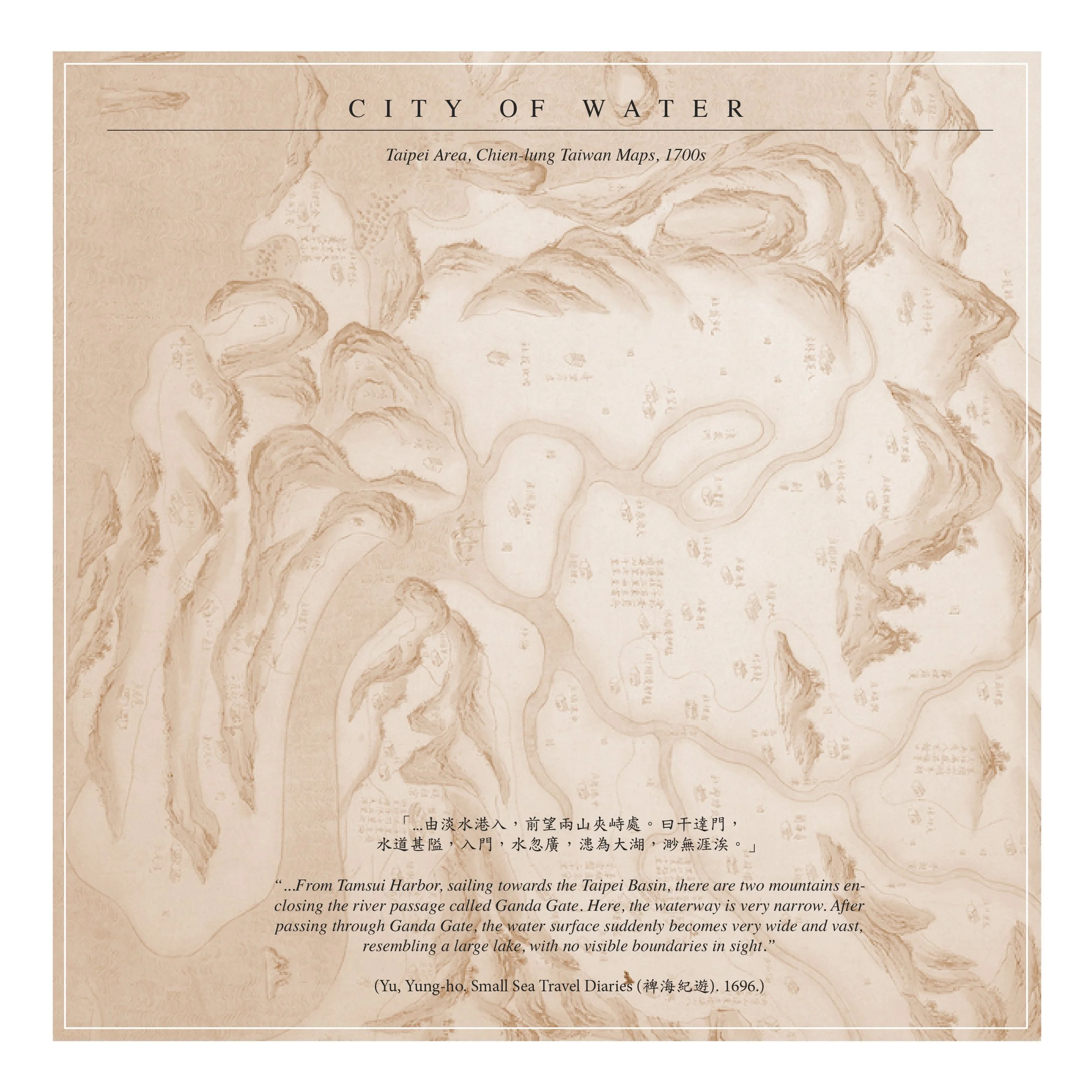
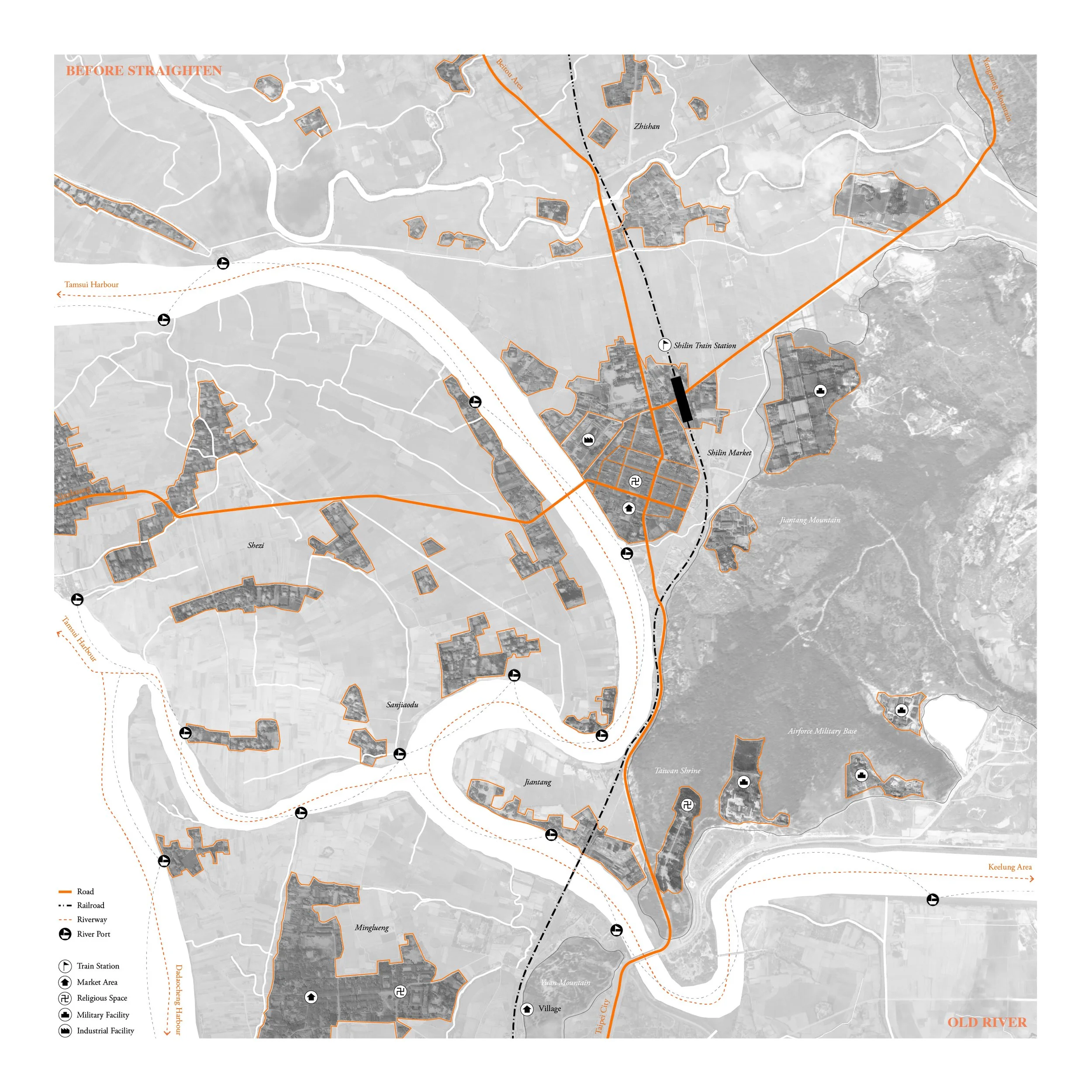
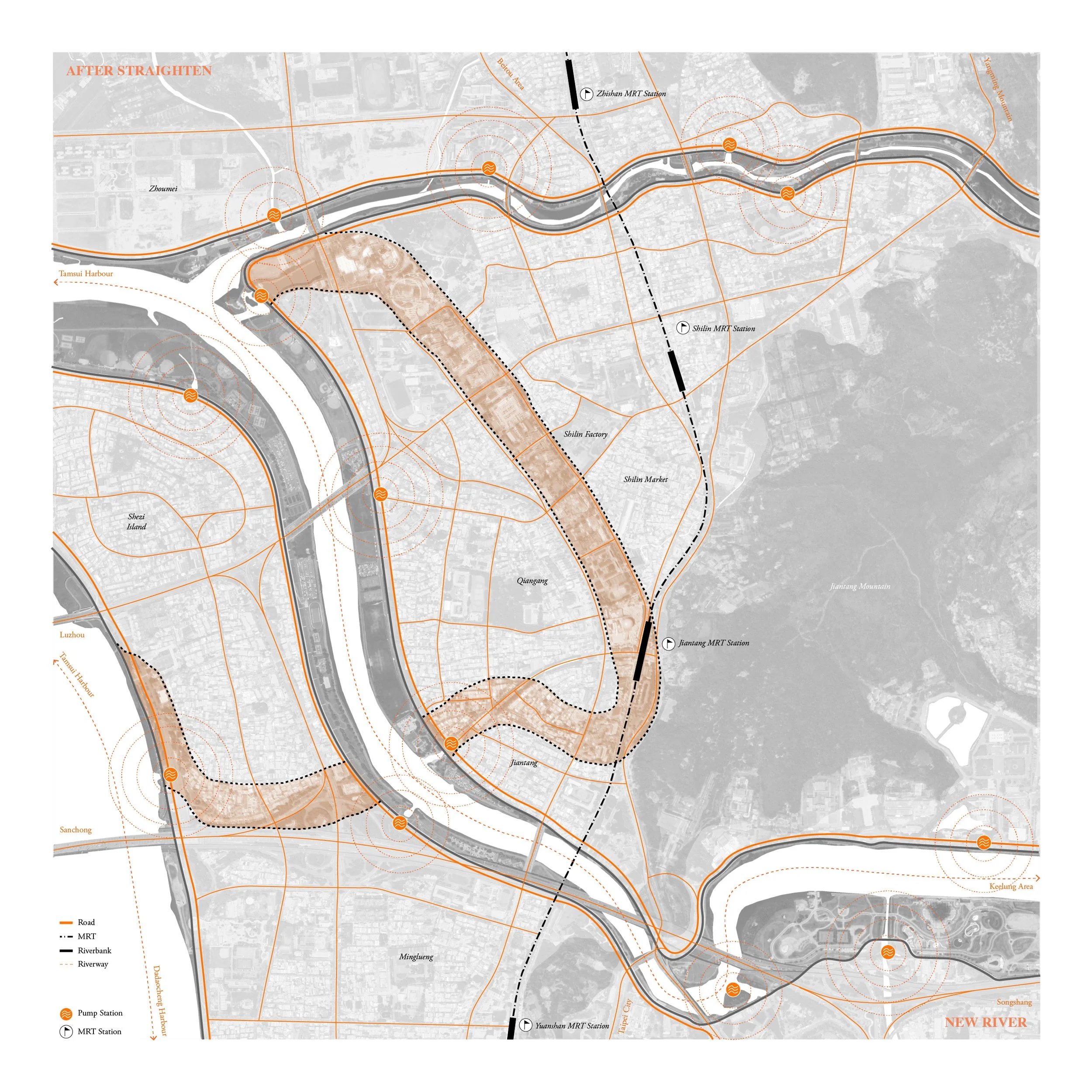
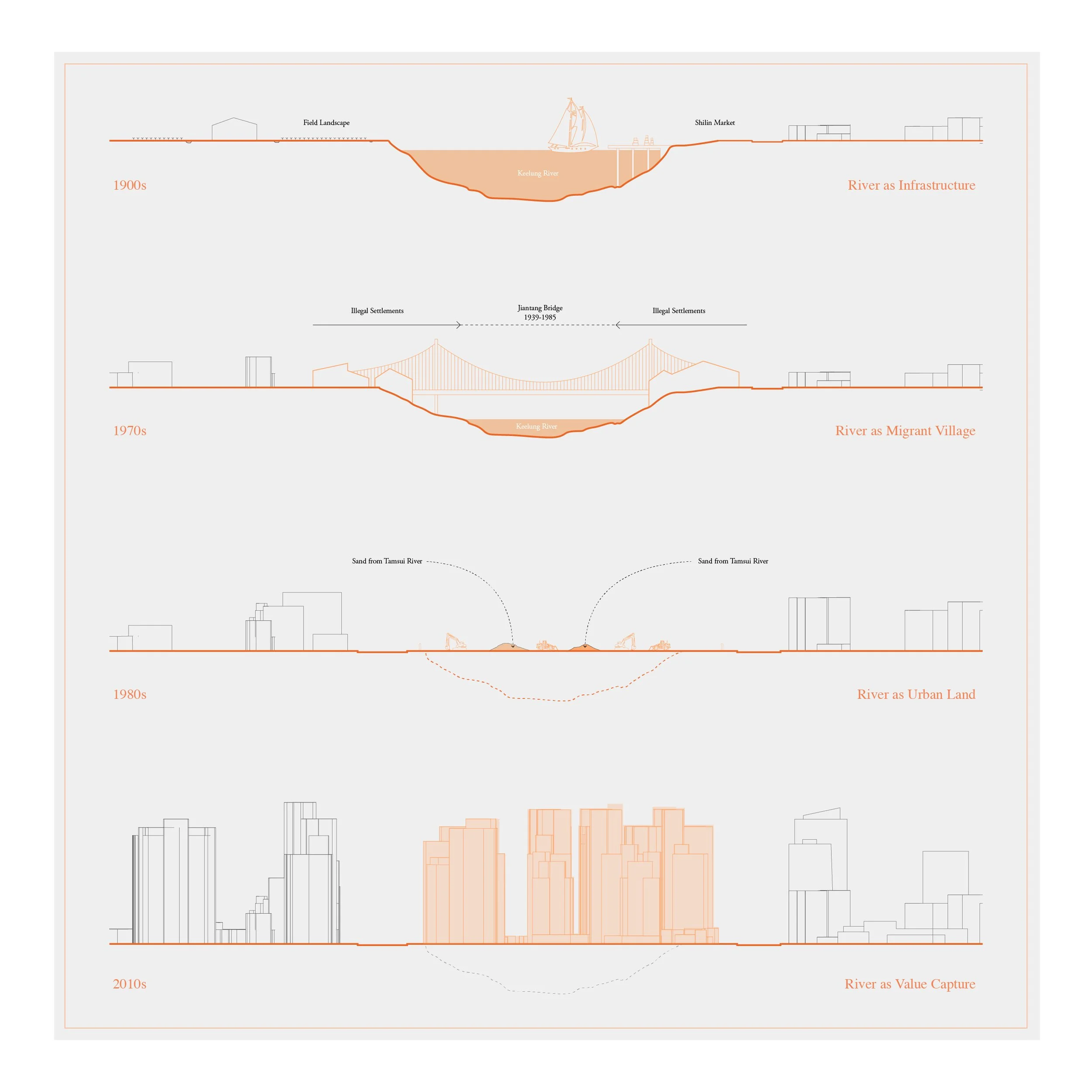
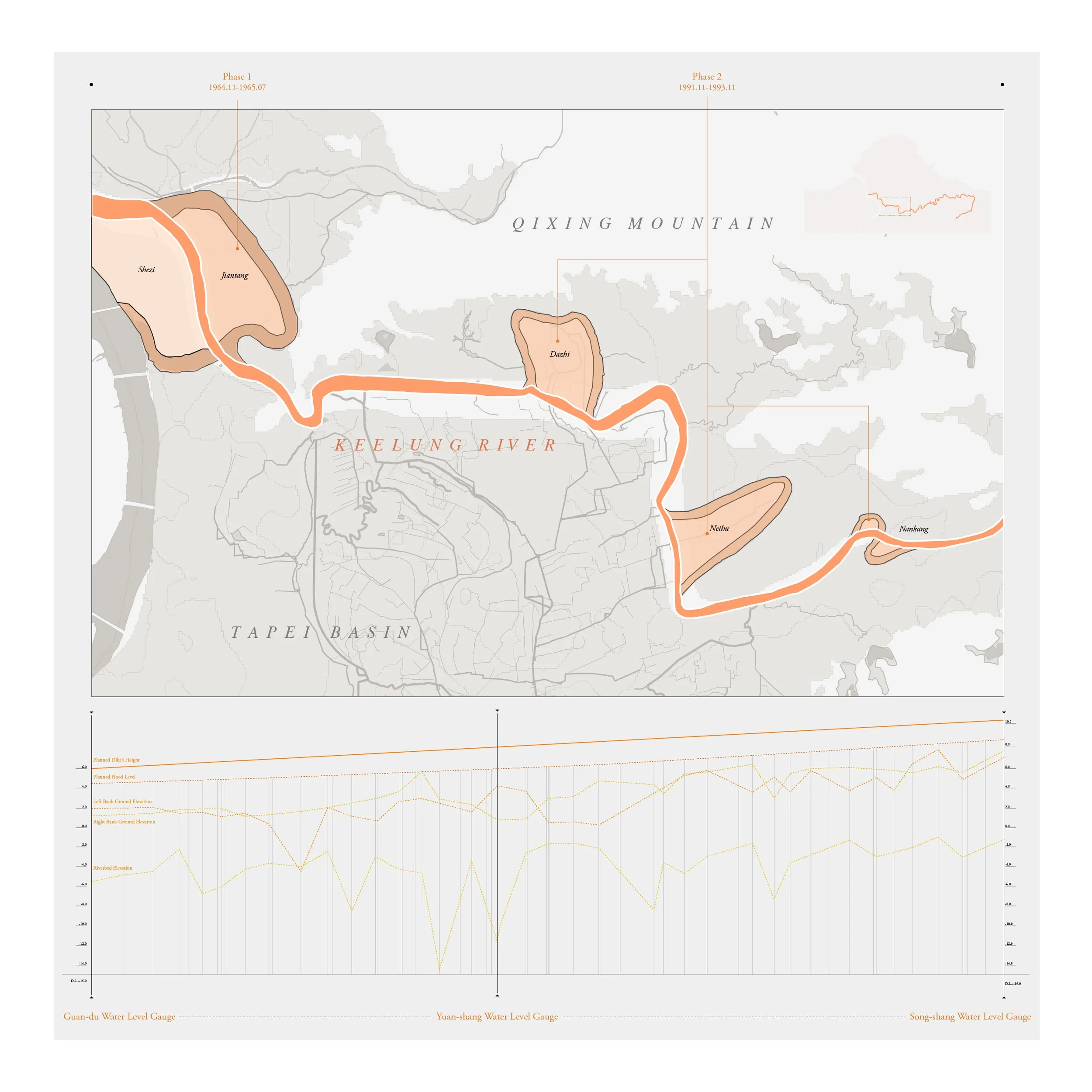
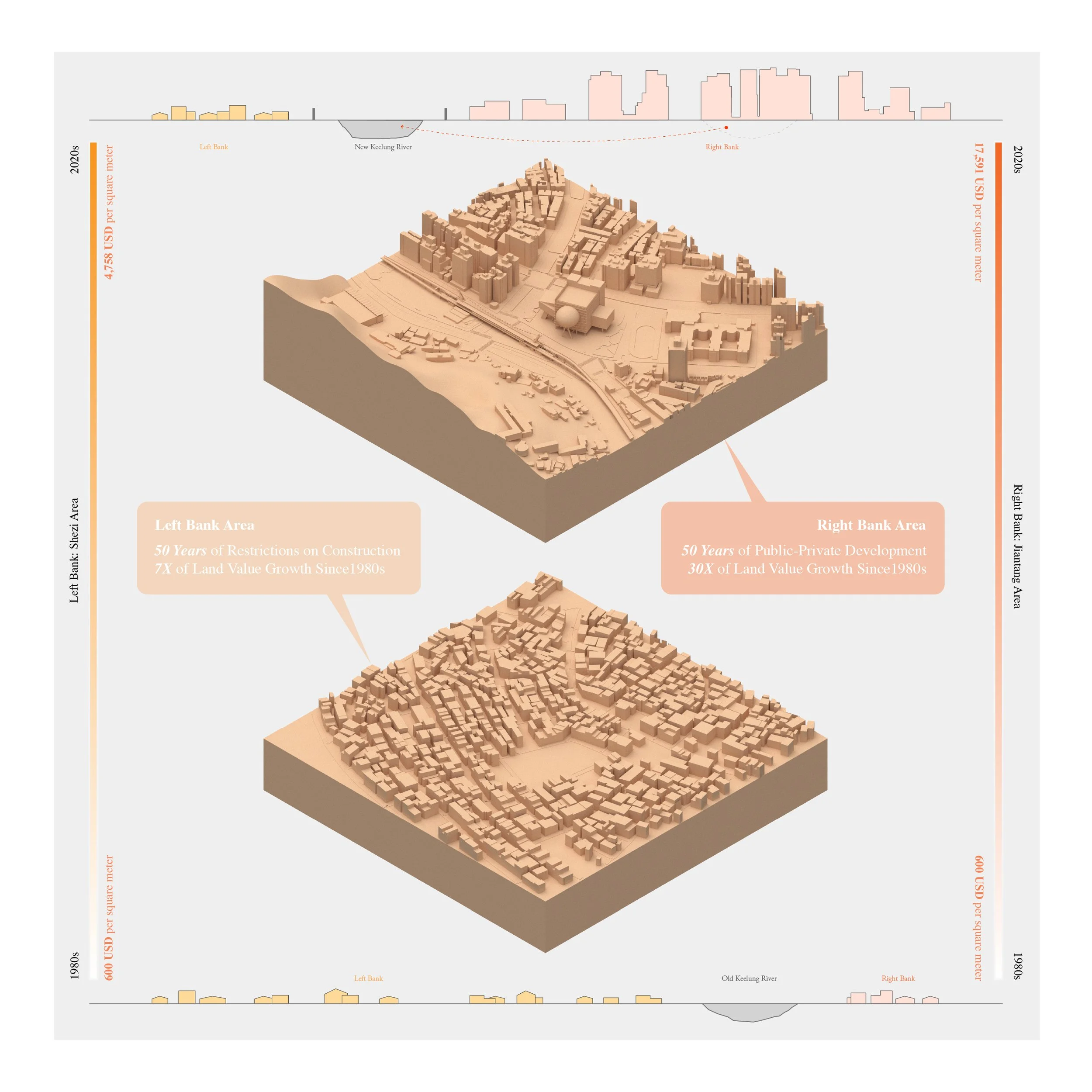
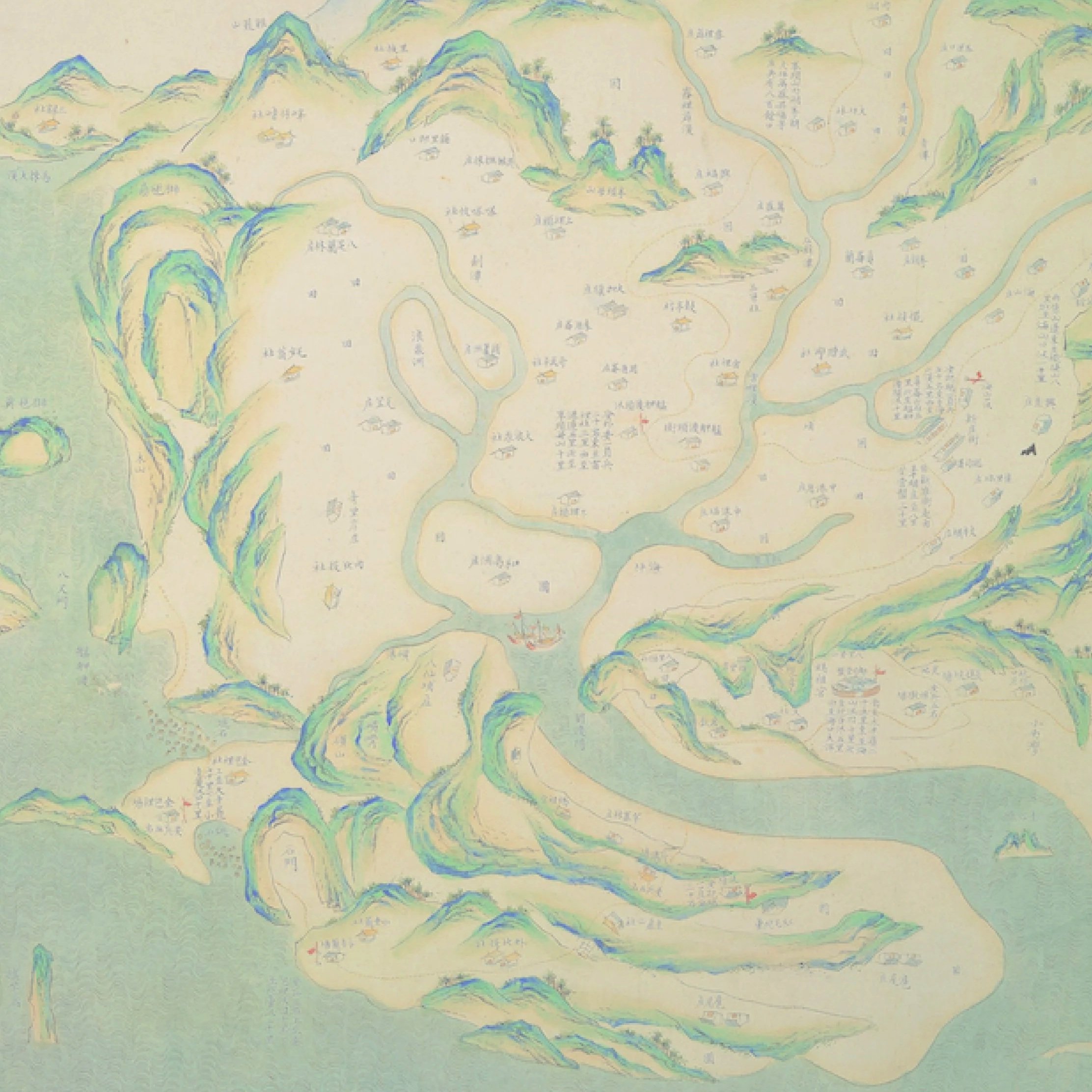
Originating from tectonic plate movements, Taipei Basin emerged as a shallow plain encircled by volcanic mountains and crisscrossed by rivers that early inhabitants relied on for farming, fishing, and trading. Over centuries, its riverscape was rewritten under colonial mandates, political upheavals, and catastrophic floods. Treated solely as an engineering problem, the government’s 1960s Keelung River straightening plan aimed to shield the growing metropolis from recurring deluges. In practice, it rerouted waterways, sealed tributaries, and filled old riverbeds—burying layers of asphalt and landfill atop centuries of environmental and social memory.
This project brings the story of this “invisible stream” to light by archiving from Qing-era diaries (late 1600s), Japanese colonial–era flood control plans (early 1900s), U.S. Army Corps consultations during the Cold War (mid 1900s), and GIS spatial analysis. The research unfolds in three phases: historical hydrology, mid-century rectification, and subsequent land redevelopment. Geo-visualizations trace lost river bends and newly formed urban blocks; oral histories reveal how communities adapted to shifting shorelines; and land-value data, combined with policy analysis, expose a dramatic economic rift along the redefined riverbanks. By revealing these transformations, the study demonstrates how top-down environmental planning reshaped Taipei’s lands, rivers, and societies, uncovering ecological disruption, social fragmentation, and economic disparity.
The Life and Death of Keelung Riverscape
-
2024
-
Urban & Environmental Research
-